Architecture · imported, unverified
Nitriansky hrad
castle
Nitra · Nitriansky kraj · Slovakia
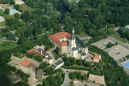
Nitriansky hrad is a well-preserved castle complex in Nitra. Situated on a castle hill in the town centre at an altitude of 220 m, it forms a prominent landmark beneath the southern slopes of Tribeč. Originally it covered the entire castle hill and upper town, about eight and a half hectares. Key landmarks include Katedrála svätého Emeráma, the bishop's palace, and massive fortifications with bastions.
Text: Wikipédia: Nitriansky hrad (opening paragraph, possibly shortened), licensed under CC BY-SA 4.0. Contributors are listed in the article history. This text may be redistributed under the same terms.
Description machine-translated from the original text; help us fix any mistakes. Report an error
Coordinates
48.31814, 18.08676

Coordinates of the feature; for paths and areas, these mark the centre, not a shooting position.
Navigation and sources
Imported data, not yet checked by a person. © OpenStreetMap (ODbL)