Architecture · imported, unverified
Synagoga w Zamościu
synagogue
Zamość · województwo lubelskie · Poland
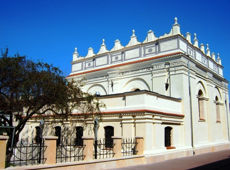
A late Renaissance synagogue from 1610–1620 on Ludwika Zamenhofa Street in the Old Town of Zamość. The masonry building is crowned by a crested attic, and the interior vaults are covered with stucco decoration.
Text: Wikipedia: Synagoga w Zamościu (opening paragraph, possibly shortened), licensed under CC BY-SA 4.0. Contributors are listed in the article history. This text may be redistributed under the same terms.
Description machine-translated from the original text; help us fix any mistakes. Report an error
Coordinates
50.71799, 23.25417

Coordinates of the feature; for paths and areas, these mark the centre, not a shooting position.
Navigation and sources
Imported data, not yet checked by a person. © OpenStreetMap (ODbL)