Industrial sites · imported, unverified
Zalaszentgróti kőhíd
bridge
Zalaszentgrót · Zala megye · Hungary
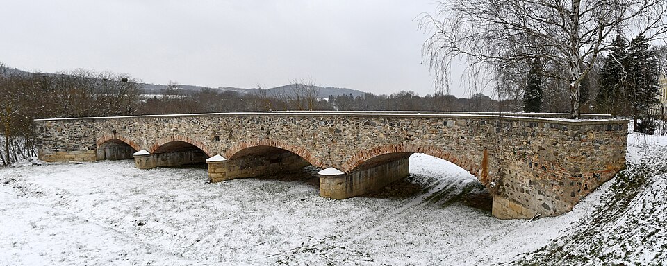
Located in Zalaszentgrót near the Batthyány-kastély, this stone bridge with four openings and three central pillars was built between 1844 and 1846. Spanning the former bed of the Zala River, the historic bridge is now accessible on foot.
Text: Wikipédia: Zalaszentgróti kőhíd (opening paragraph, possibly shortened), licensed under CC BY-SA 4.0. Contributors are listed in the article history. This text may be redistributed under the same terms.
Description machine-translated from the original text; help us fix any mistakes. Report an error
Coordinates
46.94272, 17.07168

Coordinates of the feature; for paths and areas, these mark the centre, not a shooting position.
Navigation and sources
Imported data, not yet checked by a person. © OpenStreetMap (ODbL)