Towns, cities and streets · imported, unverified
Most Stacha
bridge
municipality and region not yet available · Poland
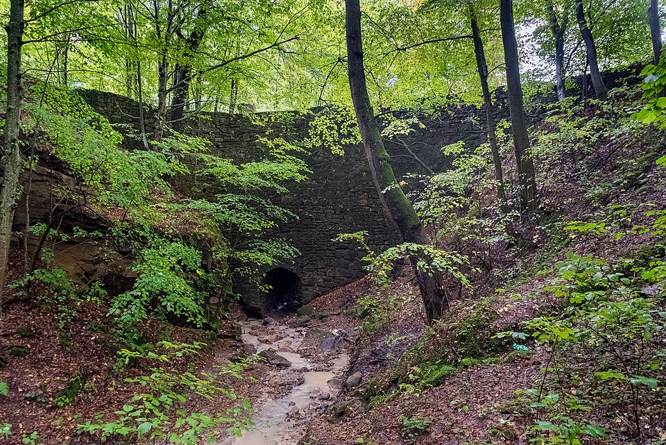
Most Stacha (zwany też „Mostem Mocarza”) – kamienna budowla znajdująca się w Znamirowicach, w województwie małopolskim, nad Jeziorem Rożnowskim. Most został wzniesiony z piaskowca typu „Siwiec” w latach 1968–1971 własnoręcznie przez miejscowego gospodarza Jana Stacha nad głębokim jarem, który uniemożliwiał dojazd do gospodarstwa. Wysokość budowli wynosi 13 m, długość 20 m, a szerokość 7,5 m.
Text: Wikipedia: Most Stacha (opening paragraph, possibly shortened), licensed under CC BY-SA 4.0. Contributors are listed in the article history. This text may be redistributed under the same terms.
Description available only in the original language for now.
Coordinates
49.73238, 20.69119

Coordinates of the feature; for paths and areas, these mark the centre, not a shooting position.
Navigation and sources
Imported data, not yet checked by a person. © OpenStreetMap (ODbL)