Architecture · imported, unverified
Fort XV Borek
fortress
municipality and region not yet available · Poland
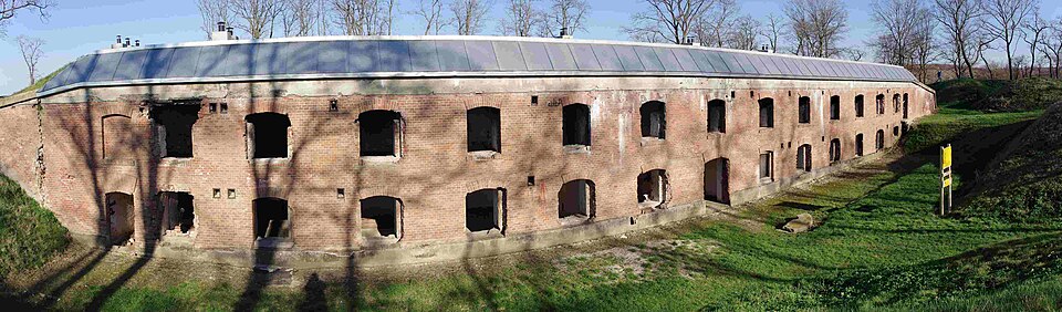
Fort W XV „Borek” – fort pancerny obrony bliskiej Twierdzy Przemyśl, o konstrukcji betonowo-murowano-ziemnej, znajdujący się obok miejscowości Siedliska. Zbudowany został w latach 1892-1900. Główne prace przy budowie fortu trwały w latach 1895-1897. Strzegł on głównego kierunku wschodniego, w tym przebiegających niedaleko drogi i linii kolejowej ze Lwowa.
Text: Wikipedia: Fort W XV „Borek” (opening paragraph, possibly shortened), licensed under CC BY-SA 4.0. Contributors are listed in the article history. This text may be redistributed under the same terms.
Description available only in the original language for now.
Coordinates
49.77147, 22.89984

Coordinates of the feature; for paths and areas, these mark the centre, not a shooting position.
Navigation and sources
Imported data, not yet checked by a person. © OpenStreetMap (ODbL)